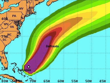
Days after projections put Hurricane Joaquin on a possible track toward the Northeastern U.S. coast -- including New York City -- the National Hurricane Center believes the massive storm will veer more to the east and stay centered in the Atlantic Ocean.
It's great news considering Joaquin's top winds increases to 155 mph Saturday, making just shy of Category 5 status.
Northeast resident's can thank a pattern meteorologists know as the "mid-latitude westerlies," which is expected to steer the storm away from them, according to the latest discussion by NHC forecasters.
"Joaquin is expected to become fully embedded within the mid-latitude westerlies and accelerate eastward toward the northeast Atlantic," they said.
Uncertainty in projections earlier in the week has been replaced by confidence in the track forecast "due to the good agreement among models," the discussion said.
While being spared a devastating direct hit -- remember Sandy? -- much of the eastern U.S. coast will be drenched in heavy rains.
Lead Stories' Trendolizer constantly scours social nets globally for the hottest trending content about hurricanes. Scroll down to see the latest.


