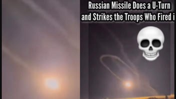
Did a Russian missile do a complete U-turn and return to strike the troops who fired it? No, that's not true: This missile launch was a failure, but the missile did not return precisely to the site of its launch. It exploded in a field nearby. The angle of one video makes it appear that the missile doubled back to its origin, but alternate angles show that the missile's path was a more open arc. The site of the failed launch and strike nearby has been geolocated on the edge of the town of Alchevs'k in the Luhansk oblast. Burn marks on the ground are visible in satellite images taken after the failed missile was fired from a position on the other side of a large field.
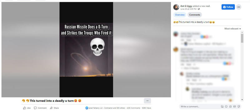
Videos of a failed missile launch began to appear on social media on June 23, 2022. Some posts were captioned to imply the missile completed a full U-turn like a boomerang. One example was posted on Facebook on June 25, 2022. The video was captioned and titled:
This turned into a deadly u turn
Text captioning added to the video reads:
Russian Missile Does a U-Turn and Strikes the Troops Who Fired it
This is how the post appeared at the time of writing:
(Image source: Facebook screenshot taken on Thu Jun 30 20:03:52 2022 UTC)
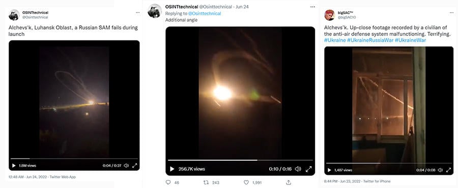
Lead Stories does not have information regarding whether any soldiers or civilians were killed or injured in this failed missile launch. This image below shows the arc of the missile's path at about the same moment in time, filmed from three different vantage points. The videos were shared on Twitter on June 24, 2022, (here and here) and on June 23, 2022 (here).
(Image source: Lead Stories composite image of Twitter screenshots taken on Thu Jun 30 20:20:18 2022 UTC)
Since the start of the war in Ukraine, the Centre for Information Resilience has been maintaining a map to record and verify footage and reports of war incidents. This incident is recorded with an orange pin signifying a "bombing, shelling or explosion" at the coordinates, "48.467144, 38.848144." The details associated with this entry include an embedded tweet featuring the "U-Turn video," as well as links to three additional posts on Twitter (here, here and here). These twitter posts show open-source intelligence analysis by volunteers comparing features visible in the video footage matched with landmarks visible in satellite images. This analysis method, called geolocation, can be used to find the location of an event pictured in a video.
Two geolocation tweets are embedded below. In each, a distinctive oval roundabout can be seen on the edge of town, which helps to visualize the distance between the site of the launch and strike. The tweet below shows the general area of the missile launch outlined in light blue in the fourth image of their tweet.
Geolocation of the air defense incident in Alchevsk:
-- LEAPKVV (@leapkvv) June 24, 2022
Camera location 48.466206, 38.8410264
The explosion most likely occurred before the high-voltage pylon marked in yellow(2)
Launcher in the area of the circle(4)@GeoConfirmed pic.twitter.com/UxNxW1tGDv
The tweet below shows the scorched area of the field visible in a June 24, 2022, satellite image.
Satellite imagery from today shows a burned area at the site of a recent missile launch failure near Alchevsk, Luhansk Oblast. pic.twitter.com/dqIUt4cxeu
-- Brady Africk (@bradyafr) June 24, 2022


