

Is Mount Meru, a magnetic mountain, located at or under the North Pole at the center of a flat Earth -- and is this mountain the reason why all compasses point to the magnetic north? No, that's not true: In Hindu and Buddhist mythology, Mount Meru is the central axis of the world where gods live and the sun and planets revolve around it-- but it is not a real place and the Earth is not flat. This claim does not involve an unrelated Mount Meru in Tanzania.
The claim appears in a reel on Instagram by @the_woken_undead on March 21, 2023. The lengthy caption of the post includes 30 hashtags:
This Map Of Monte Urbano Shows Us The Four Continents That Reside At The North Pole As Well As The Giant Black Magnetic Mountain Named Mt. Meru Which Sits Directly Under the North Star And Is At The Center Of Our Great Plane. Modern Maps Today Tell Us There Isn't Anything There, Meanwhile Our Past Records Tell Us A Completely Different Story And I Have A Hard Time Accepting That Within 400+ Years That Went By Since The Creation Of This Map, That The Face Of Our Great Plane Changed That Drastically. Seems Like There Is Much More In Store To Where We Live. This Is Why I Believe "Flat Earth" Is The Biggest Conspiracy To Overcome. Because It Literally Changes Everything You We're Ever Taught To Accept. The Sun Is Smaller And Closer And Moves Through The Sky, Earth is Fixed And Immoveable..
- @the_woken_undead -
..
#spacemaybethefinalfrontierbutitsmadeinahollywoodbasement #monteurbano #nasahoax #spacehoax #spaceisfake #globelies #nasalies #nasaliars #globehoax #earthisflat101 #nasholes #earthisnotaglobe #earthisflatandstationary #isshoax #wakeup #truthseekers #awakwnthemasses #staywoke #wevebeenliedto #indoctrination #researchflatearth #planetruth #earthisarealm #spacelies #firmament #nasafrauds #enclosedsystem #planetosea #truthinplainsight #toroidaluniverse
This is how the post appeared at the time of writing: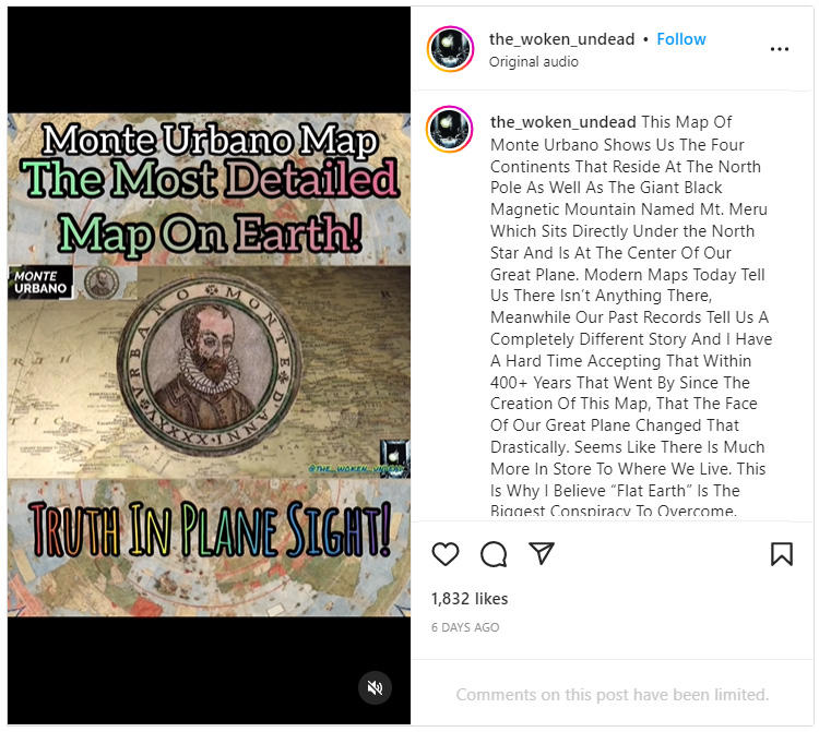
(Image source: Instagram screenshot taken on Tue Mar 28 15:47:55 2023 UTC)
There are text captions visible throughout the video that say:
Monte Urbano Map The Most Detailed Map On Earth!
TRUTH IN PLANE SIGHT!
Additional text captions appear at certain points in the narration:
He Knew The Sun Is Smaller & Local Than We Are Told Today And Revolves Around The Earth..
All Compasses Point To The Magnetic North Pole Mountain At The Center Of Our Great Plane Mt. Meru.
A magnetized compass points north due to the Earth's magnetic field. Not everything is understood about the Earth's magnetic field. Physicists today ascribe the Earth's magnetic field to a theory that an electric current is made by spiraling currents in Earth's molten iron outer core. The process that produces the electric current is called a "fluid dynamo."
Additionally the Earth's geographic North Pole, "True North," is about 1,200 miles from the magnetic pole where a compass points north. When navigating by compass, this difference must be taken into consideration and adjustments made for the local magnetic declination.
The map in the post is a real map created by scholar Urbano Monte in 1587 in the form of a bound atlas. The pieces of the map, 60 in all, make concentric rings. If assembled, the map would measure 10 feet across. There are only three known copies, two manuscripts and one printed. One of the manuscript editions is in the David Rumsey Historical Map Collection at Stanford University, described in this blog post as the "Largest Early World Map - Monte's 10 ft. Planisphere of 1587." A high-resolution image of a "virtual assembly" of the digitized map pieces can be explored at davidrumsey.com.
Mount Meru is not at the center of the map at the North Pole. A decorative compass rose is instead. This was not an attempt by Urbano to show that the Earth was flat, but merely one of the many ways a cartographer could chart the globe (with some distortion) on a two-dimensional surface.
This map presents the features of the Earth in what is known as the "North Polar projection" (below left).
Jeremy Ashkenas, a computer programmer and the graphics director of the opinion section of The New York Times, created a 3D-modeled globe from the digitized North Polar Projection map of Monte's Planisphere (screenshot below right).
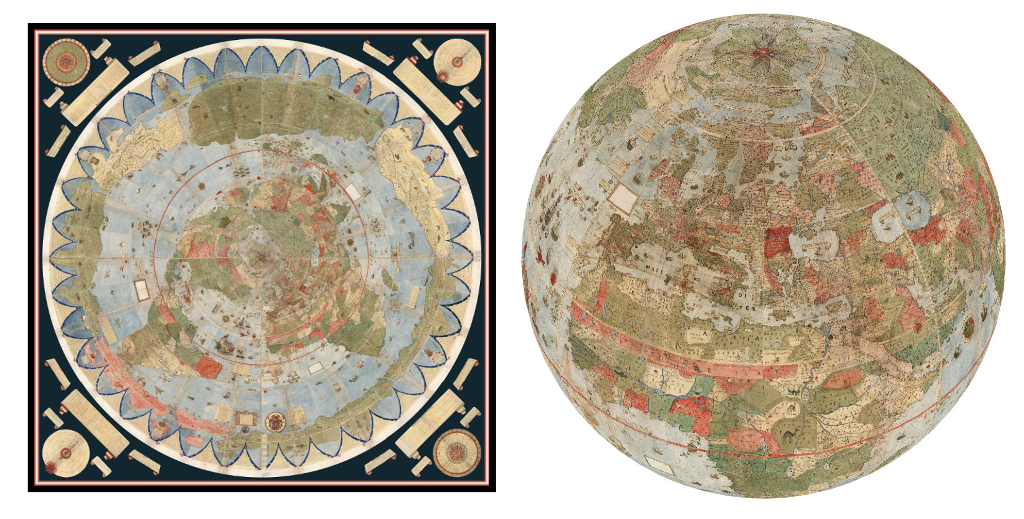
(Image source: Screenshots from davidrumsey.com and observablehq.com taken on Thu Mar 30 00:23:22 2023 UTC)
This high-resolution virtual globe can be tipped and spun with a cursor. Zooming in will reveal a high level of detail and many characters, both realistic and fantastic, including ships on the ocean, sea monsters and a bird carrying an elephant away in its talons.

(Image source: Screenshot from davidrumsey.com taken on Thu Mar 30 00:23:22 2023 UTC)