Do weather projections as of October 16, 2024, forecast another hurricane to hit Florida, as a post on TikTok suggested? No, that's not true: Designated AL94 at the time of writing, a weather system over the Atlantic in mid-October was a disturbance -- not a hurricane, according to the National Weather Service. Though AL94 may develop into a hurricane, the storm's projected path as of October 16, 2024, was near the Leeward and Virgin Islands in the northwest Caribbean Islands -- not Florida.
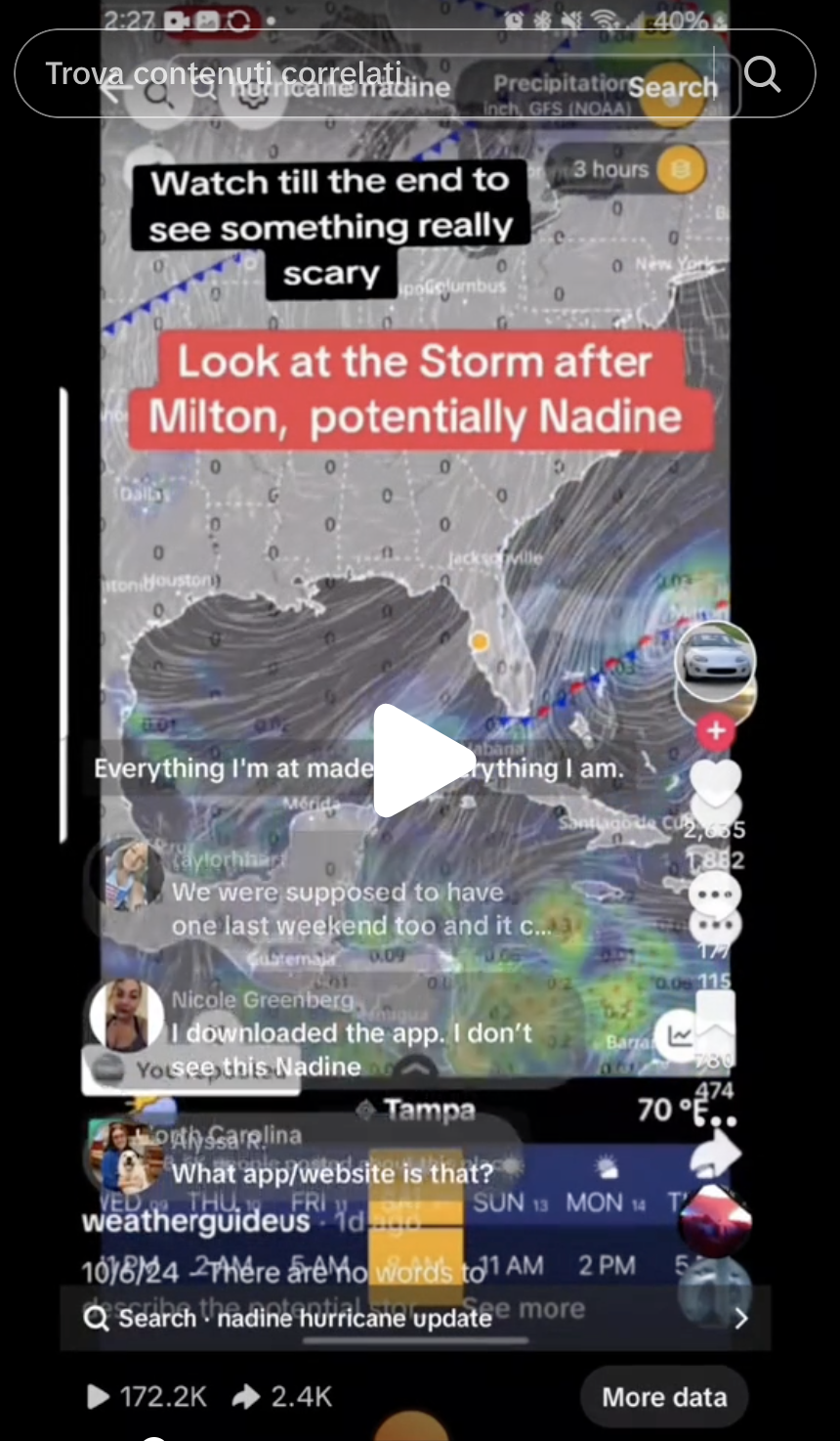
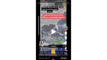
The claim was made in a video on TikTok on October 8, 2024, (archived here) showing storm conditions over Florida.
A text overlay read, "GET OUT OF FLORIDA!" and the caption read:
Hurricane Nadine is a possibility. You cannot rule this one out. So sorry Floridians! Get Out While You Can!! #weather #fyp #Florida #Nadine #hurricanenadine #hurricanes #hurricanemilton #forecast #news #viral #mega #viralvideo
This is how the post appeared at the time of writing:
(Source: TikTok screenshot taken Wed Oct 16 14:06:00 2024 UTC)
The National Weather Service (NWS) defines (archived here) a disturbance as:
A tropical weather system with organized convection (generally 100-300 miles in diameter) originating in the tropics or subtropics, having a non-frontal migratory character and maintaining its identity for 24 hours or longer. It may or may not be associated with a detectable perturbation of the wind field.
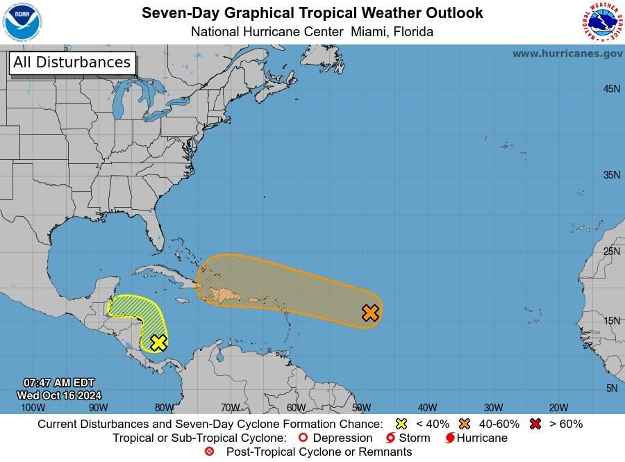
NWS published (archived here) a description of the system to Facebook on October 16, 2024, writing:
This Wednesday, a broad area of low pressure located over the central tropical Atlantic is producing disorganized showers and thunderstorms. This system is forecast to move generally westward to west-northwestward, and environmental conditions appear marginally conducive for gradual development during the latter part of this week. A tropical depression could form as the system moves near the Leeward and Virgin Islands late this week. It has a low (30 percent) chance of formation in the next 48 hours and a medium (40 percent) chance in the next 7 days.
In the western Caribbean Sea showers and thunderstorms over the southwestern Caribbean Sea are associated with a broad area of low pressure. Some gradual development is possible if the system stays over water while it moves slowly northwestward towards Central America. Regardless of development, locally heavy rainfall is possible across portions of Central America later this week. It has a low (10 percent) chance of formation in the next 48 hours and a low (20 percent) chance in the next 7 days.
(Source: Downloaded from Facebook Wed Oct 16 21:00:00 UTC 2024)
An advisory on October 16, 2024, noted that AL94 is forecast to move westward to west-northwest, and conditions are "marginally conducive" for gradual development later in the week.
"A tropical depression could form as the system moves near the Leeward and Virgin Islands late this week," the National Hurricane Center wrote (archived here).
If the system develops into a hurricane, it could be named "Nadine." The World Meteorological Society names hurricanes and keeps a rotating list of approved names (archived here). In 2024, the hurricane following Milton will be called "Nadine."
The video shared on X included a TikTok watermark with the username "weatherguideus," which is self-described on its profile page as "Weather and Environment Enthusiast."
The original video was published (archived here) to TikTok on October 6, 2024, with a caption identifying the system as "the potential storm Nadine." It was initially one minute and 28 secon long, sped up and incorporated with other text to create the15-second version on TickTok.
At the time this was written, PolitiFact had reviewed a similar claim.
Previous Lead Stories fact checks of claims concerning hurricanes can be found here.

