Does President Donald Trump's executive order changing the name of the Gulf of Mexico to the Gulf of America help enforce newly drawn borders decided in December 2023 by a "World Court" that gives water over land shelves to the respective countries? No, that's not true: Executive Order 14172 is a direction to the Secretary of the Interior to rename the entire body of water that was formerly known as the Gulf of Mexico to the Gulf of America on "maps, contracts, and other documents and communications." The executive order does not change or enforce legal boundaries for maritime traffic.
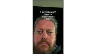
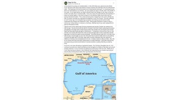
The claim appears in a lengthy post published on Facebook (archived here) on January 26, 2025, along with a map showing the renamed "Gulf of America." The text of the post begins:
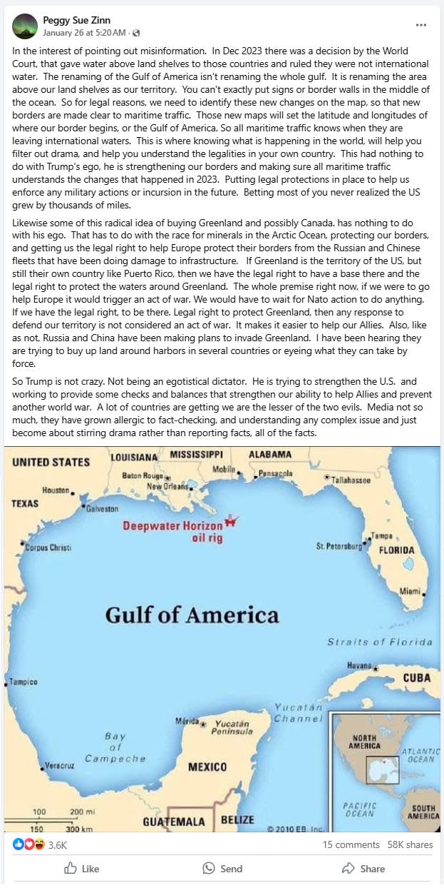
In the interest of pointing out misinformation. In Dec 2023 there was a decision by the World Court, that gave water above land shelves to those countries and ruled they were not international water. The renaming of the Gulf of America isn't renaming the whole gulf. It is renaming the area above our land shelves as our territory. You can't exactly put signs or border walls in the middle of the ocean. So for legal reasons, we need to identify these new changes on the map, so that new borders are made clear to maritime traffic. Those new maps will set the latitude and longitudes of where our border begins, or the Gulf of America. So all maritime traffic knows when they are leaving international waters.
This is what the post looked like on Facebook at the time of writing:
(Source: Facebook screenshot taken on Fri Feb 21 21:19:53 2025 UTC)
The post continues:
This is where knowing what is happening in the world, will help you filter out drama, and help you understand the legalities in your own country. This had nothing to do with Trump's ego, he is strengthening our borders and making sure all maritime traffic understands the changes that happened in 2023. Putting legal protections in place to help us enforce any military actions or incursion in the future. Betting most of you never realized the US grew by thousands of miles.
Likewise some of this radical idea of buying Greenland and possibly Canada. has nothing to do with his ego. That has to do with the race for minerals in the Arctic Ocean, protecting our borders, and getting us the legal right to help Europe protect their borders from the Russian and Chinese fleets that have been doing damage to infrastructure. If Greenland is the territory of the US, but still their own country like Puerto Rico, then we have the legal right to have a base there and the legal right to protect the waters around Greenland. The whole premise right now, if we were to go help Europe it would trigger an act of war. We would have to wait for Nato action to do anything. If we have the legal right, to be there. Legal right to protect Greenland, then any response to defend our territory is not considered an act of war. It makes it easier to help our Allies. Also, like as not, Russia and China have been making plans to invade Greenland. I have been hearing they are trying to buy up land around harbors in several countries or eyeing what they can take by force.
So Trump is not crazy. Not being an egotistical dictator. He is trying to strengthen the U.S. and working to provide some checks and balances that strengthen our ability to help Allies and prevent another world war. A lot of countries are getting we are the lesser of the two evils. Media not so much, they have grown allergic to fact-checking, and understanding any complex issue and just become about stirring drama rather than reporting facts, all of the facts.
The scope of this fact check will not extend to the maritime law specifics of the Exclusive Economic Zone (EEZ) and the Extended Continental Shelf (ECS) and will focus on the claim that Trump's order to rename the Gulf draws and enforces "new borders" and that the order only renames a part of the Gulf. That is false -- the executive order directs the Secretary of the Interior to rename the entire body of water.
Executive Order 14172--Restoring Names That Honor American Greatness
On January 20, 2025 President Donald Trump signed an executive order (archived here). The purpose and policy is introduced in section one:
It is in the national interest to promote the extraordinary heritage of our Nation and ensure future generations of American citizens celebrate the legacy of our American heroes. The naming of our national treasures, including breathtaking natural wonders and historic works of art, should honor the contributions of visionary and patriotic Americans in our Nation's rich past.
The official renaming of the Gulf of Mexico to the Gulf of America is described in section four of the order. :
(b) As such, within 30 days of the date of this order, the Secretary of the Interior shall, consistent with 43 U.S.C. 364 through 364f, take all appropriate actions to rename as the "Gulf of America" the U.S. Continental Shelf area bounded on the northeast, north, and northwest by the States of Texas, Louisiana, Mississippi, Alabama and Florida and extending to the seaward boundary with Mexico and Cuba in the area formerly named as the Gulf of Mexico. The Secretary shall subsequently update the GNIS to reflect the renaming of the Gulf and remove all references to the Gulf of Mexico from the GNIS, consistent with applicable law. The Board shall provide guidance to ensure all federal references to the Gulf of America, including on agency maps, contracts, and other documents and communications shall reflect its renaming.
Lead Stories reached out to the U.S. Department of the Interior, sharing the text of the post in question and asked for clarification regarding whether the entirety of the Gulf was renamed, or just a part of it, and if the renaming changes or enforces any borders. We received an email reply on February 25, 2025, from J. Elizabeth Peace, the senior public affairs specialist at the Office of the Secretary of the U.S. Department of the Interior. Peace wrote:
The implementation instruction from the Secretary's Order directed the feature previously known as the Gulf of Mexico to be renamed to the Gulf of America. The authoritative database (GNIS) was updated to be consistent with that instruction, and now contains the description of the feature and name that is official for federal use. DOI does not have authority to change legal boundaries for maritime traffic and I would refer you to the Department of State or the White House for clarification and answers to your questions.
A February 14, 2025, notice (archived here) was published by the U.S. Geological Survey (USGS) Communications and Publishing Department titled, "USGS and the U.S. Board on Geographic Names have implemented name changes following Executive and Secretary's Orders." Several USGS apps now using the new name are mentioned, including National Map Viewer, Lidar Explorer, and the Geographic Names Information System Search Tool. Several of the apps display notices (the composite image below will open larger in a new screen) explaining that they are actively working to address some issues in the renaming process either in regards to the Gulf of America (order no. 3423 archived here) or Mount McKinley (order no. 3424 archived here):
Per Secretary's Order 3423 and 3424 the default display map on the Gazetteer application reflects the newly named Gulf of America and Mount McKinley. The USGS is aware of issues occurring outside of CONUS and Alaska impacting boundaries and labels of features, and is actively working towards addressing these.
Per Secretary's Order 3423 and 3424 the default display map on The National Map Viewer reflects the newly named Gulf of America and will soon reflect the newly named Mount McKinley. The USGS is aware of issues occurring outside of CONUS and Alaska impacting boundaries and labels of features, and is actively working towards addressing these.
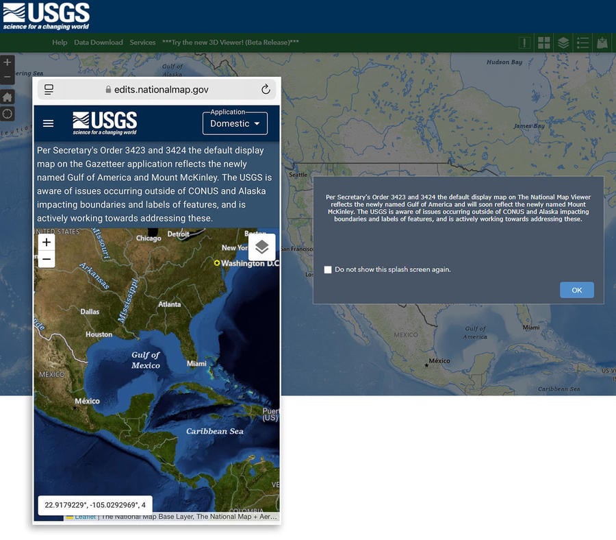
(Source: Lead Stories composite image with USGS Gazetteer and National Map Viewer screenshots taken on Wed Feb 26 16:39:08 2025 UTC)
The Gazetteer map (pictured above left) still displays the words "Gulf of Mexico" although a text search for either name will return information on the Gulf of America, this includes a summary report #558730 which describes the feature in detail:
The Gulf of America, formerly known as the Gulf of Mexico, with an average depth 5300 ft is a major body of water bordered and nearly landlocked by North America with the Gulf's eastern, northern, and northwestern shores in the U.S. and its southwestern and southern shores in Mexico. Bordered by Cuba on the SE, it connects to the Atlantic Ocean via the Florida Straits between the U.S. and Cuba, and the Caribbean Sea via the Yucatan Channel between Mexico and Cuba. In common usage, the term "Gulf Coast" refers to the continuous portion of the coast running from Cape Sable, FL to the northern tip of the Yucatan Peninsula; in geographic usage it extends East from and to include the Florida Keys to the northerly sides of the Keys there. The Gulf of America spans over 1,700 miles of U.S. coastline.
The Extended Continental Shelf
The U.S. Department of State has a FAQ about the Extended Continental Shelf Project. The provisions for recognizing ECS limits of coastal states (nations) were not set by a "World Court in December 2023" but were set in Article 76 (page 47 of the .pdf) of the United Nations 1982 Law of the Sea Convention. The Department of State describes the distinction between the Continental Shelf and EEZ:
The continental shelf and the exclusive economic zone (EEZ) are distinct maritime zones (Figure 1). The continental shelf includes only the seabed and subsoil, whereas the EEZ also includes the water column. In addition, while the maximum extent of the EEZ is 200 nautical miles from the coast, the continental shelf may extend beyond 200 nautical miles, depending on the depth, shape, and geophysical characteristics of the seabed and sub-sea floor. The ECS is, therefore, not an extension of the EEZ. Some of the rights that a coastal State may exercise in the EEZ, especially rights over water column resources (e.g., fish), do not apply to the ECS.
The map (pictured below left) shows the ECS shaded in red and includes the words, "Gulf of America" above the line indicating the U.S. Maritime Limits and Boundaries, an area called the Exclusive Economic Zone (EEZ). An earlier edition of this map (archived here) predating the January 2025 Executive Order 14172 (below right), shows the same label placement, but with the text "Gulf of Mexico". These labels are for the entire body of water and not indicating only the zone north of the line.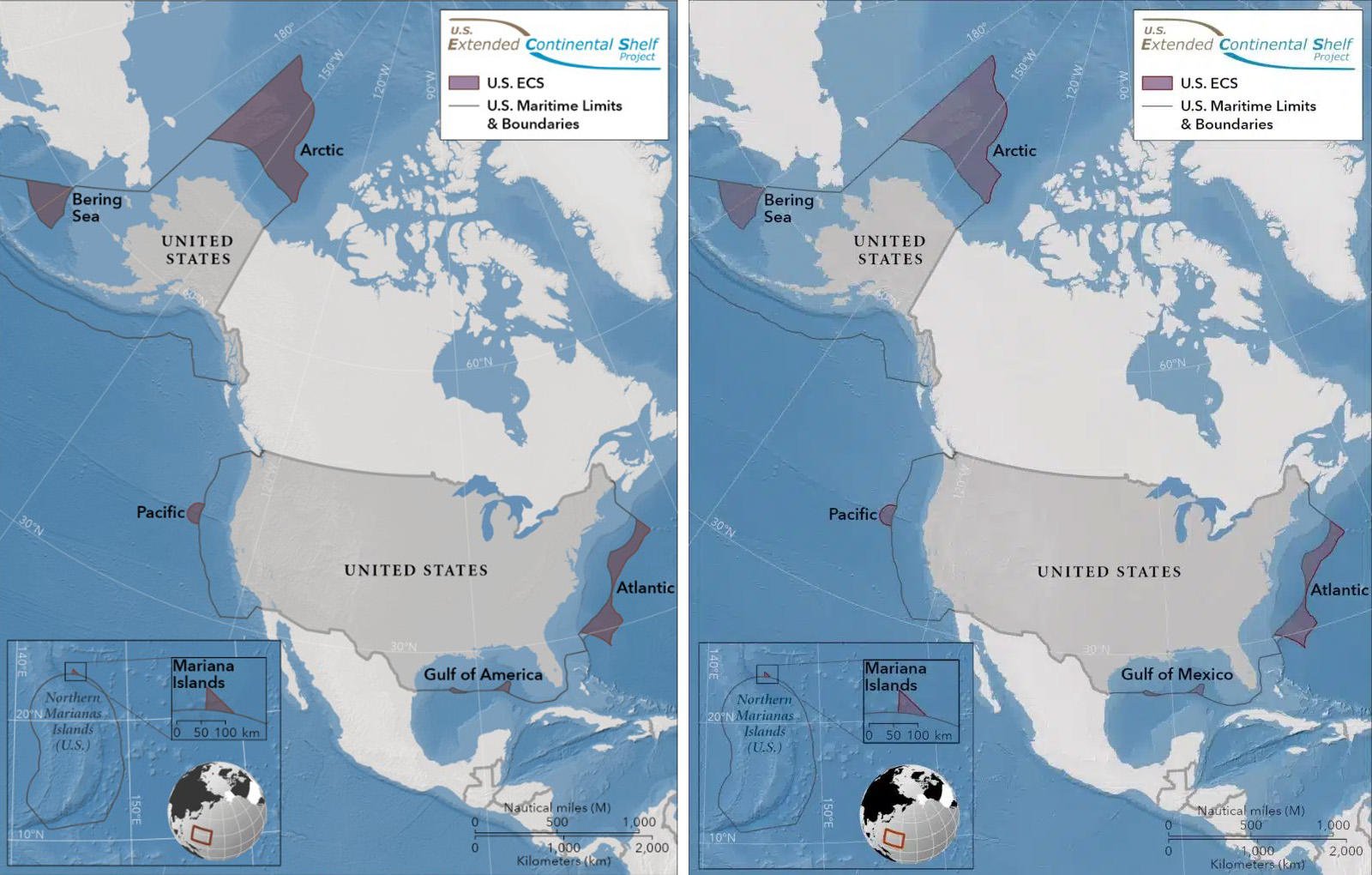
(Source: state.gov and thearcticinstitute.org screenshots taken on Wed Feb 26 19:09:25 2025 UTC)
The National Oceanic and Atmospheric Administration (NOAA), one of the 15 agencies involved with the ECS project, has been mapping the ocean floor in seven different areas off the shores of the United States since 2003. After 20 years of work, on December 19, 2023, the U.S. Department of State released an executive summary (PDF archived here) titled "The Outer Limits of the Extended Continental Shelf of the United States of America." This report has been recently revised (PDF here) to reflect the name change to Gulf of America. The name change does not change any aspect of the physical, territorial, or legal limits of the ECS as described in the executive summary.
Lead Stories reached out to the U.S. Department of State, NOAA, and The U.S. Naval War College and will update this article if a response is received.
Additional Lead Stories fact checks on claims involving the Gulf of America can be found here.