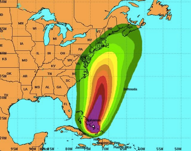
Hurricane Joaquin's top sustained winds grew to 130 mph Thursday, making it a Category 4 hurricane, according to the National Hurricane Center. The latest tracking map released by the NHC shows the potential for the storm's eye to approach New Jersey and New York Tuesday.
However, the latest forecasting models give reason for hope the northeastern United States could avoid a direct hit by Joaquin's force, according to the discussion section on the NHC's hurricane webpage: "A strong majority of the forecast models are now in agreement on a track farther away from the United States east coast. We are becoming optimistic that the Carolinas and the mid-Atlantic states will avoid the direct effects from Joaquin. However, we cannot yet completely rule out direct impacts along on the east coast, and residents there should continue to follow the progress of Joaquin over the next couple of days."
The hurricane was moving toward the southwest through the central Bahamas at just 6 mph Thursday. "A turn toward the north is expected on Friday, and a faster motion toward the north is expected Friday night and Saturday," the NHC advisory said.
These predictions come with a warning that the storm could do something other than what was predicted.
Not surprised at NHC cone given low confidence in guidance past 84 hours. Still expecting widespread coastal impacts pic.twitter.com/fttZOsFloy
-- Jim Cantore (@JimCantore) October 1, 2015
Lead Stories' Trendolizer constantly scours social nets for the windiest trending content about hurricanes. Scroll down to see the latest.


