
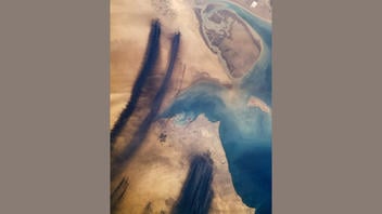
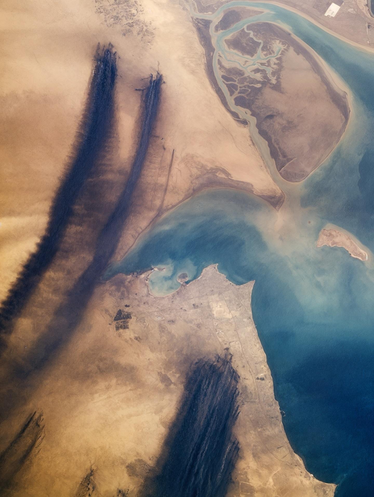
Does a satellite image show fires currently burning in the Middle East? No, that's not true: This satellite image dates back to April 1991. It does not show anything currently burning in the Middle East, but shows oil well fires burning in Kuwait during the Gulf War.
The image appeared in a post on X (archived here) where it was published without comment by @stparabellum on March 8, 2026.
This is the image included in the post:
(Image source: post from @stparabellum on X.)
A reverse image search with Google Lens found the image in NASA's "Earth From Space" collection, dated April 1991 (archived here). The text caption included with the image reads:
STS037-152-091 Oil Well Fires and Smoke, Kuwait April 1991
The effects of Iraq dictator Saddam Hussein's setting fire to the oil wells in Kuwait during February 1991 is graphically captured in this near-vertical photograph of the northwestern end of the Persian Gulf. The black smoke plumes of more than 700 individual oil well fires are being blown to the south. Kuwait City is located on the south side of Kuwait Bay, southwest of the Tigris-Euphrates Delta. Fortunately, the oil well fires were extinguished in much less time than had been originally predicted, and the environmental damage created by the fires and smoke was mostly confined to the immediate region around the northwestern Persian Gulf. (Refer to STS-046-074-094 for a photograph of the same area to see how quickly the desert is reclaiming the land in this region.)
The image also appears in NASA's "Gateway to Astronaut Photography of Earth" collection dated Apr. 7, 1991. It was archived by the Internet Archive as early as 2008, confirming the image's existence long before the current conflict in the Middle East.