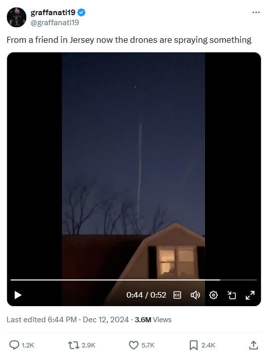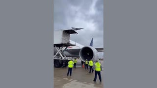
Does a video captured by a New Jersey resident show a drone spraying something in the sky? No, that's not true: The video showed a commercial Boeing 777 jetliner gradually descending as it nears the end of a transatlantic flight from London to Baltimore. Lead Stories cross-referenced the timestamp and location tag from the original video with flight and weather data archives to identify the jet in the video. An expert in clouds and aerosols reviewed the video and satellite imagery, concluding the supposed spray looks like contrails from a high-flying aircraft.
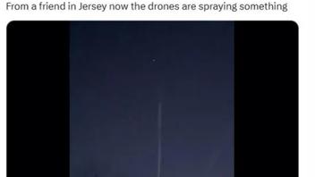
The video was posted on X (archived here) on December 12, 2024, with the caption:
From a friend in Jersey now the drones are spraying something
This is how that post appeared at the time of writing:
(Source: X screenshot taken on Fri Dec 13 23:48:10 2024 UTC)
The original video was filmed and posted on Instagram by Steven Catalano on December 12, 2024. Lead Stories contacted Catalano for an uncompressed video copy, which was slightly less grainy than copies posted on social media. Critically, the timestamp and the geotag on the original video gave precise information that indicated what would have been visible from the ground.
The scope of this fact check does not extend to any other videos or sightings of actual or misidentified drones or other lights present in this video footage by Catalano. This fact check focused on whether the video in question showed something being sprayed from a drone -- which it did not. It showed a moonlit contrail produced by a large passenger jet starting its descent from cruising altitude.
Catalano joined a YouTube livestream with the "Special Not Rare" channel on December 15, 2024, to discuss the drones in New Jersey. Starting at the 4:52 minute mark, he said:
I'm going to give you my opinion and it's just my opinion, I could be wrong. And you know what I mean, like from what I've seen from these drones over the last three, four weeks they're very sophisticated. They, I personally, I don't have a military background but it doesn't take a fuckin'... excuse me, but like an astronaut to understand that these things, these things are sophisticated. They don't look like aliens to me. They're drones, you know what I'm saying, so like it looks like some kind of government high-level military surveying is going on. That's what's kind of been going on. Now, it's progressively gotten more and more and more. Now it's wild, I mean I got, there's drones going every direction all over my house. There's got to be 30 to 40 at a time that I could see just in my area, in my town, I mean, so they're all over the state. Yeah planes don't fly like that. I lived in this house for almost seven years and I know my house. I know what goes over, flies over my house for the most part.
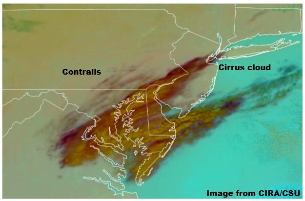
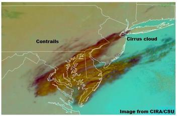
Lead Stories contacted Edward Gryspeerdt, a lecturer in atmospheric physics at the Imperial College London, to review the video. He responded by email on December 16, 2024, with a marked-up screenshot (pictured below) and a link to the source, weather satellite imagery, from the Cooperative Institute for Research in the Atmosphere (CIRA) at Colorado State University.
The image showed a patch of contrails in the region moving in a northeasterly direction, indicating that the weather conditions were on track for contrail formation.
When asked if the video showed what appeared to be contrails, Gryspeerdt wrote:
These look like contrails from a high-flying aircraft. If the conditions are right, when jet engine exhaust mixes with the surrounding air, it can form a cloud - in the same way your breath can form a little cloud on a very cold day. Light from the moon and light pollution from cities can make clouds easily visible at night.
Weather satellite images on this day showed a patch of high cloud over the north NJ/south NY region along with some contrails further to the west. This region has a large amount of commercial air traffic - this video is likely showing contrails forming behind one of these aircraft.
(Source: Gryspeerdt marked-up screenshot of CIRA/CSU data)
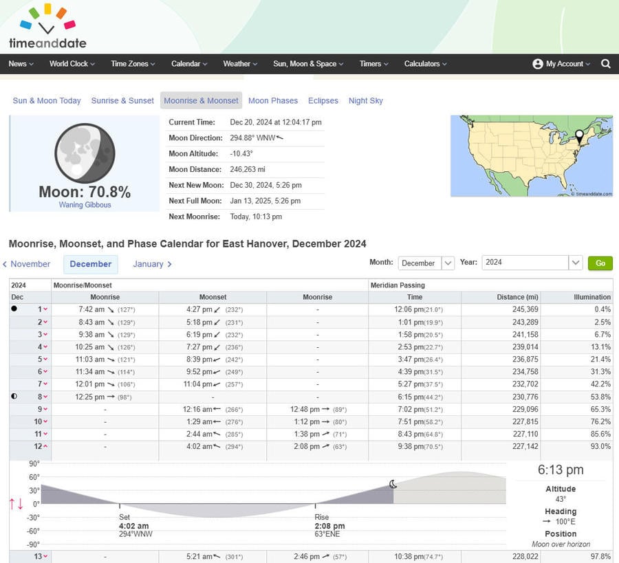
The moon is visible momentarily at 38 seconds into Catalano's video, but it is not in the frame at the same time as the contrail. Lead Stories used the website timeanddate.com (pictured below and archived here) to determine the altitude and heading of the moon as seen from East Hanover, New Jersey, at 6:13 p.m. EST on December 12, 2024. A heading of 100 degrees east is just slightly south of true east.
(Source: timeanddate.com screenshot taken on Fri Dec 20 17:40:32 2024 UTC)
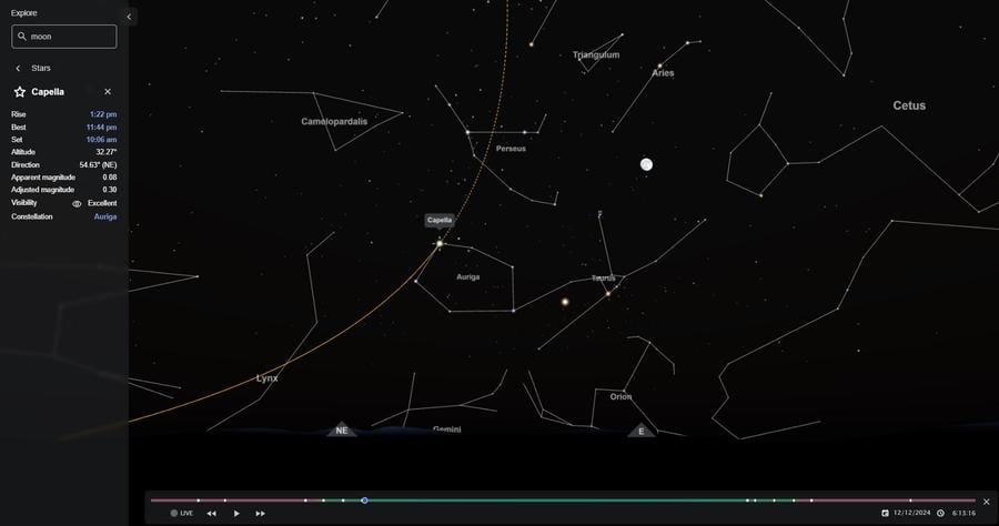
Timeanddate.com also has a chart of the night sky showing the view at the horizon with the cardinal and ordinal directions marked. The sky chart can be adjusted to show a specific place, date and time (pictured below).
(Source: timeanddate.com screenshot taken on Fri Dec 20 17:45:28 2024 UTC)
Lead Stories contacted amateur astronomer and science author Stuart Atkinson to identify the star that appears directly over the plane when the video begins. Using charts and the moon's position for reference, Atkinson determined it was the multistar system Capella, which shows the visible trail was seen coming from the northeast by east direction.
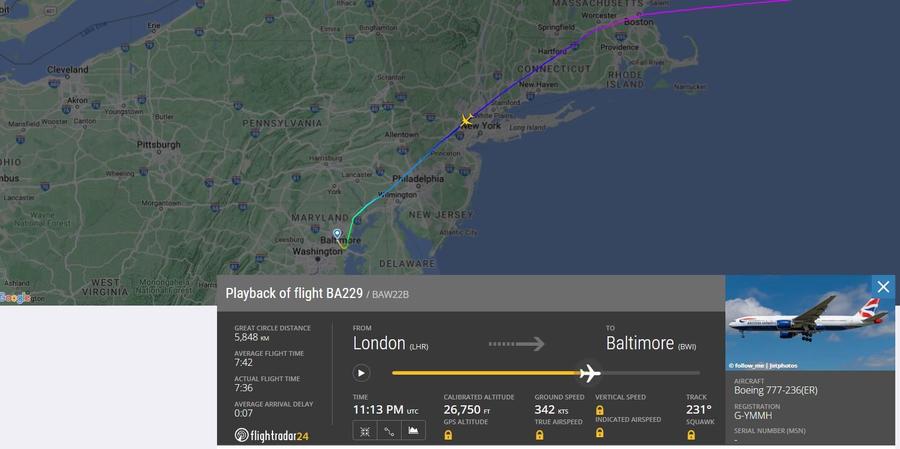
The Flight Radar 24 database (archived here) identified a flight approaching East Hanover at 6:13 p.m., coming from the northeast in the east direction -- it's a British Airways Boeing 777-236(ER) (archived here) nearing the end of flight 228 from London to Baltimore. The multicolored line of the flight path on the map below illustrates the plane's altitude along the route and shows that the jetliner was descending over New Jersey as it approached its destination. In the screenshots below, the time is either 11:13 p.m. UTC or 23:13 -- both represent 6:13 p.m. local time (EST is five hours behind UTC).
(Source: flightradar24.com screenshot taken on Thu Dec 19 23:58:46 2024 UTC)
The chart below shows a graph of the speed in yellow and altitude in blue, measured in 20,000-foot increments during the flight. The added inset (outlined in green) shows an altitude of 27,625 feet at 23:13:17 UTC -- just 64 seconds later, the plane had descended another 1,600 feet.
(Source: Lead Stories composite image with flightradar24.com screenshots taken on Thu Dec 19 23:58:46 2024 UTC)
Although the plane in the video appears to be going straight up, this is an illusion caused by perspective. The distant tail of the contrail is not coming from below but from far away -- made at a jet's cruising altitude of just under 40,000 feet. As the descending jetliner flew toward East Hanover, it produced a contrail until it reached a lower altitude where the dewpoint would no longer develop or sustain a contrail. This is why the contrail abruptly ends while the plane continues to fly.
In September 2000, the Environmental Protection Agency, NASA, the National Oceanic and Atmospheric Administration and the Federal Aviation Administration produced a six-page factsheet (archived here) on aircraft contrails. It explains that if the humidity is low, the contrail will be short-lived:
If the humidity is high (greater than that needed for ice condensation to occur), the contrail will be persistent. Newly formed ice particles will continue to grow in size by taking water from the surrounding atmosphere. The resulting line-shaped contrail extends for large distances behind an aircraft (See Figures 2 and 3). Persistent contrails can last for hours while growing to several kilometers in width and 200 to 400 meters in height. Contrails spread because of air turbulence created by the passage of aircraft, differences in wind speed along the flight track, and possibly through effects of solar heating.
Lead Stories has published several fact checks on conspiracy claims regarding "chemtrails," which can be read here. Two in particular discuss atmospheric conditions involved with contrail formation and how long they last, visible here and here.
Additional Lead Stories fact checks on claims about drones can be found here.

