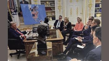
Did Donald Trump post a photo where he shows European leaders a map of North America with Canada, Greenland and Venezuela covered in the U.S. flag? Yes, that's true: Trump did post the image on his Truth Social account, but the image was doctored. It was originally taken in August 2025, and the map did not show Canada, Greenland and Venezuela covered in the U.S. flag. The original image was posted by official U.S. government social media accounts showing a map without the Stars and Stripes.
The image appeared in a July 14, 2026, post on Truth Social account @realDonaldTrump (archived here).
This is what the post looked like on Truth Social at the time of writing:

(Image source: post by @realDonaldTrump on Truth Social.)
The image was originally posted on the official Instagram account of the U.S. Mission to the EU @useu (archived here) and was taken during a meeting between Trump and European leaders in the Oval Office in August 2025. The map in this photo showed Ukraine and surrounding areas, not North America, Greenland and Venezuela covered in the American flag, as this screenshot shows:
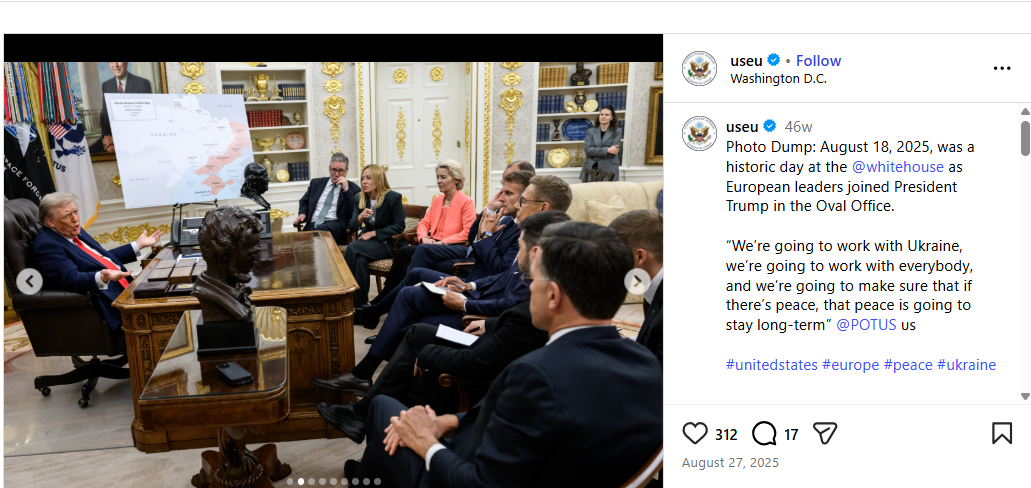
(Image source: post by @useu on Instagram.)
The image was also posted on the White House Flickr account (archived here) with a credit that read, Official White House Photo by Daniel Torok, as this screenshot shows:
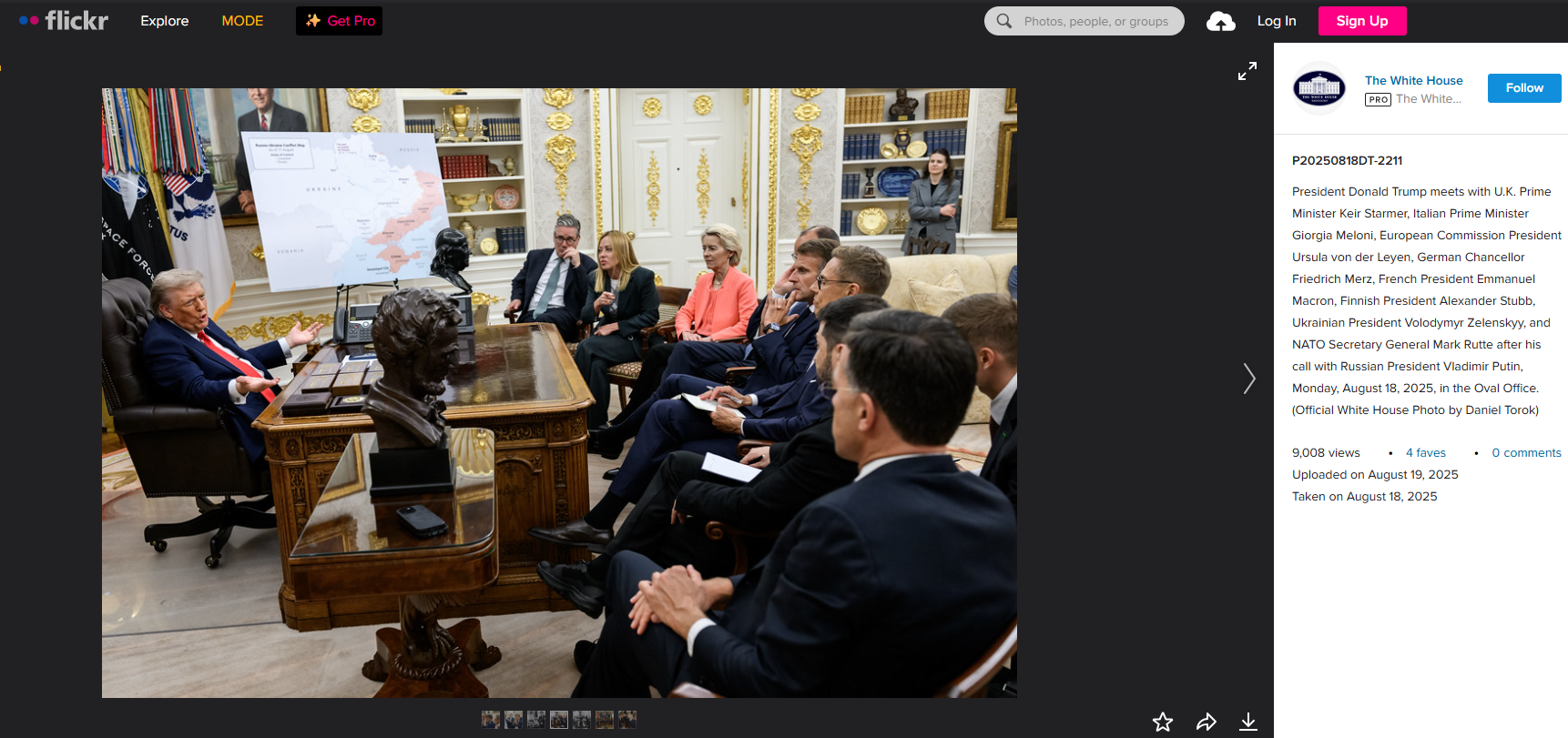
(Image source: post by The White House on Flickr.)
Other Fact Checks
This claim was also investigated by Snopes.