
Was Hurricane Dora, which passed nearly 500 miles south of Hawaii, too far away to fan the deadly wildfires that killed scores of people on Maui in early August 2023? No, that's not true: The flames that raced across western Maui were driven by a combination of a high-pressure system to the north and Dora, a low-pressure system, to the south. This mix funneled strong winds over Hawaii from the northeast to the southwest.
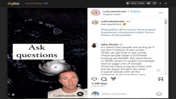
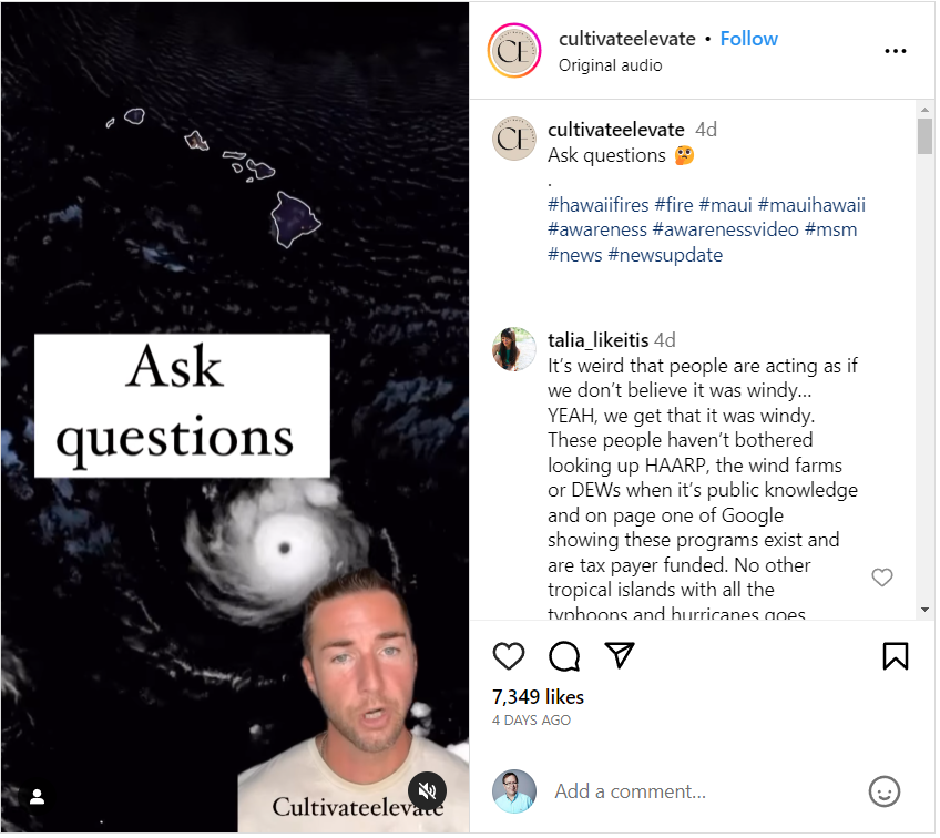
The claim appeared in a post and video on Instagram on August 16, 2023, under the title "Ask questions." The post's caption says:
Ask questions 🤔
.
#hawaiifires #fire #maui #mauihawaii #awareness #awarenessvideo #msm #news #newsupdate
This is what the post looked like on Instagram at the time of writing:
(Source: Instagram screenshot taken on Mon Aug 21 15:42:21 2023 UTC)
The video
During the 89-second video, a narrator lays out his case. A transcript of the first 49 seconds of the clip is included below:
So today, I want to give a little update on the Hawaiian fire situation. I want you guys to look at this. This is the hurricane right here. And these are the islands.
Look at the distance between these two. Now, we know hurricanes can produce storm surges, which cause a lot of flooding. We know that they can have a lot of wild winds. But if we look at the location from the hurricane and the islands, it's almost 500 miles away.
So what was causing the crazy winds that everybody was witnessing? What was causing all the fires? Why were people forced back into the city when the city was on fire? Why was the water shut off so that people couldn't defend themselves against these fires?
The narrator asks a lot of questions but offers no evidence that something nefarious has taken place. In a previous social media post, the same man said the Maui wildfires were caused by a directed energy weapon assault, which was debunked by Lead Stories.
National Weather Service
John Bravender, a meteorologist at the National Weather Service (NWS) office in Honolulu, Hawaii, told Lead Stories in an August 21, 2023, email that "Hawaii was well outside of Hurricane Dora's wind field." But that doesn't mean the storm system didn't play a role in the Maui wildfires. He continued:
The damaging winds we saw were the result of the strong pressure gradient across the state and a low and stable subsidence inversion just above the top of the mountains. Dora provided indirect enhancement to the wind by tightening the gradient between it and the subtropical high north of the state as well as possibly strengthening the inversion because of sinking air away from the intense thunderstorms associated with the hurricane.
Definitions
Bravender uses a few terms a non-meteorologist might not be familiar with: pressure gradient and subsidence inversion. Their definitions are below:
A pressure gradient is "the amount of pressure change occurring over a given distance." The tighter the pressure gradient, the higher the winds are.
A subsidence inversion is a "temperature inversion that develops aloft as a result of air gradually sinking over a wide area and being warmed by adiabatic compression, usually associated with subtropical high pressure areas."
National Weather Service map
The NWS map below shows the conditions that were in place as the deadly wildfires began on the evening of August 8, 2023, local time. Clockwise winds were circulating around the high-pressure system north of Hawaii, while counterclockwise winds were rotating around Hurricane Dora, a low-pressure system, to the south. The two parallel blue lines represent the winds being forced between them, which fanned the flames with gale-force wind gusts up to 67 miles per hour in Maui County, the National Weather Service reported, according to Reuters. In the graphic, the Hawaiian Islands are located between the two blue arrow heads.

(Source: Provided by National Weather Service on Mon Aug 21 2023 UTC)
This tweet from the NWS shows the flames and smoke from the wildfires. Maui is located just to the right-center of the animation:
Several #wildfires are burning across parts of Hawaii this week, fueled in part by strong winds from Hurricane Dora passing to the south. @NOAA's GOESWest was tracking the hotspots and smoke from the fires as they burned across parts of Maui and the Big Island yesterday evening.... pic.twitter.com/WzApS2ddTi
-- NOAA Satellites (@NOAASatellites) August 9, 2023
Additional Lead Stories fact checks of claims related to Maui wildfires can be found here.